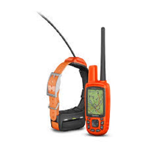
Garmin Astro 430 Handheld with 1 T5 Collar
500,00 €
In StockThe Astro 430 is compatible with a wide range of Garmin devices that let you wirelessly connect and transfer data unit-to-unit. For example, the outdoor Garmin DriveTrack™ 70 GPS navigator can receive and display dog positions on its moving map – with TOPO or satellite image views – showing navigation cues to your dog’s current location.
Description
The Astro 430 is a handheld powerhouse of dog-tracking performance, with the ability to track and follow up to 20 dogs with fast 2.5 second location updates. It is intuitive and easy to use and features a vibrant 2.6-inch color display, preloaded TOPO Lite AU/NZ mapping, an optional in-unit rechargeable battery and Hunt Metrics data to help analyse your dogs’ tracking habits in the field – so you can know how to train them more effectively.
Keep Track of up to 20 Dogs
The Astro 430 can be paired with the Garmin T 5 collar device (sold separately), allowing you to transmit each dog’s location as often as every 2.5 seconds – while also being able to see your dog’s current location and a trail of where it’s been on the Astro’s bright, crisp display. A Dog Track page gives you a compass pointing to your dog’s location. When tracking multiple dogs, you can see them all on the map page with auto zoom and the ones that are too far away will be shown on the display’s margin in the direction they are in. You can reduce visual clutter on the map by toggling between “show all”, “show some” and “show none” modes – selecting the duration that each dog’s track is viewable on the display. Let others view your dog’s location on their unit’s map by sharing a dog track code and by sharing a dog’s control code, you can allow another person to configure and control your dog’s on-collar device.
Compatible with TOPO and City Navigator NT Maps
Several mapping options are available for the Astro 430 through its microSD slot, including TOPO Lite AU/NZ. You can also opt for City Navigator AU/NZ map data which gives you turn-by-turn driving directions on roads. Additionally, the Astro 430 supports BirdsEye Satellite Imagery (a free 1-year subscription is included) which allows you to download satellite images to your device and integrate them with your maps. The Astro’s mapping depicts important nearby geographical features and enables you to see if your dog has crossed a creek or is nearing a dangerous roadway.
You can also transform paper and electronic maps into downloadable maps for your device with the Garmin Custom Maps software, free of charge.
Set Multiple Specialised Waypoints
After you’ve tracked down your quarry, mark the exact spot with Astro’s Covey Counter™, a special waypoint that shows the exact location, time of day and elevation where you found your prey as well as the number of birds you flushed and took from that location. Save other special waypoints, such as “Truck” and “Lodge” so you can easily find your way back to these locations at the end of a hunt. Additional special waypoints are available to represent food plots, tree stands and other hunting related points.

Reviews
There are no reviews yet.